Approximate Location Map
Large Map »
This site is entirely user-supported. See how you can help.
Latitude: 59.1364 / 59°8'11"N
Longitude: -3.3312 / 3°19'52"W
OS Eastings: 323922
OS Northings: 1028496
OS Grid: HY239284
Mapcode National: GBR L44L.8R1
Mapcode Global: WH691.SMX9
Entry Name: Brough of Birsay, settlements, church and related remains
Scheduled Date: 12 March 1929
Last Amended: 3 March 1999
Source: Historic Environment Scotland
Source ID: SM90034
Schedule Class: Cultural
Category: Ecclesiastical: church; Secular: settlement, including deserted, depopulated and townships
Location: Birsay and Harray
County: Orkney Islands
Electoral Ward: West Mainland
Traditional County: Orkney
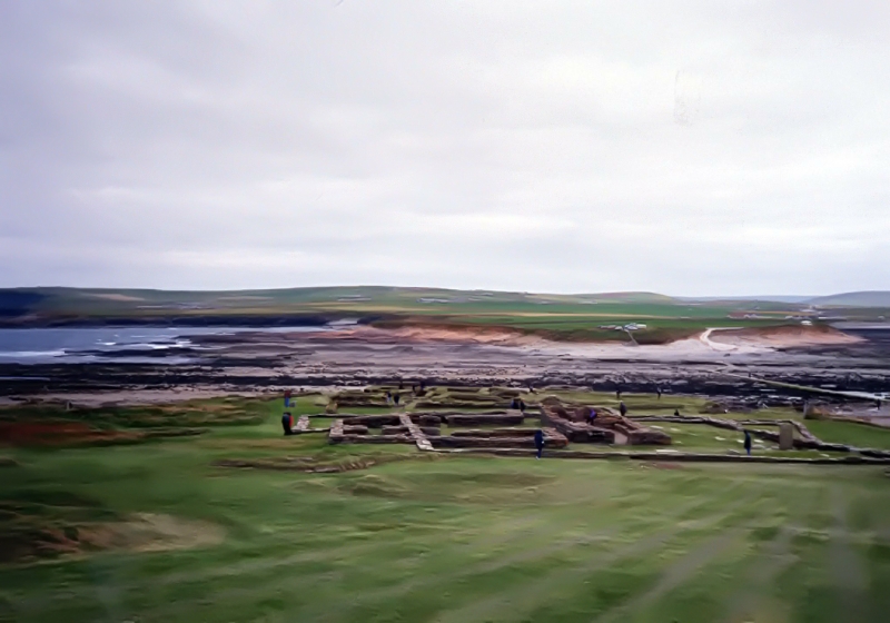
The monument comprises the area of late Iron Age to medieval settlements and ecclesiastical remains in the care of the Secretary of State and a contiguous area to the NW and west, structures on the Little Brough, and an area containing a wall running between the latter and the area in the care of the Secretary of State. Parts of the area are already scheduled, but this proposal consolidates and extends the protected area to include all of the known remains.
The monument includes remains of late Iron Age (or Pictish) settlements, Norse settlements and a church and monastic buildings. It also includes, outwith the area in the care of the Secretary of State, works associated with the springs above and to the west of the settlements, and a small structure (of which two slabs are visible) which lies about 40m NW of the fence bounding the area in the care of the Secretary of State and between 6.5 and 9m to the NE of a line running from the centre of the site interpretation centre through the westmost corner of the area in the care of the Secretary of State. It also includes the buildings and other remains on the Little Brough and a wall running along the cliff edge from the area in the care of the Secretary of State to the Little Brough.
The area to be scheduled is irregular in shape. Its most northerly point is the strainer post of the fence at the northernmost point of the area in the care of the Secretary of State for Scotland. The area has maximum dimensions of 540m between its NE-most point and its SW-most point by 170m WNW-ESE. The central part of the W side runs parallel to the fence marking the western side of the area in the care of the Secretary of State for Scotland. The strip along the SE side of the Brough of Birsay is up to 26m wide along the cliff edge to the Little Brough and includes all of the Little Brough. The E and S sides of the area, plus the N side of the Little Brough, are defined by the high water mark of ordinary spring tides as shown on the Ordnance Survey map, excluding only the area of shingle stretching towards the tidal causeway. The area to be scheduled is marked in red on the accompanying map extract.
Source: Historic Environment Scotland
Bibliography
No Bibliography entries for this designation
Historic Environment Scotland Properties
Brough of Birsay
https://www.historicenvironment.scot/visit-a-place/places/rthuns
Find out more
Source: Historic Environment Scotland
Other nearby scheduled monuments